Mapping stories
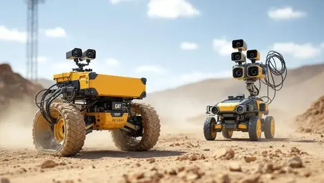
oToBrite bundles GMSL2 camera kits with Jetson Orin
Last month
#
robots
#
edge computing
#
edge ai
oToBrite unveils plug-and-play GMSL2 camera kits for Jetson Orin, streamlining rugged multi-camera edge AI trials on robots and off-highway machines.

Commercial drone automation set to soar across industries
Fri, 23rd May 2025
#
agricultural technology
#
surveillance
#
edge computing
A Forrester report finds 78% of automation leaders plan to implement aerial drone automation within a year, boosting efficiency across industries.

5G-enabled drones usher in era of smart possibilities
Thu, 28th Mar 2024
#
agricultural technology
#
data analytics
#
iot
1,500 5G-enabled drones commanded a magical spectacle over Marina Bay, heralding a revolution in drone technology offering limitless smart solutions.

Tech trio Carbonix, RIEGL & Phase One revolutionise aerial surveying
Tue, 5th Mar 2024
#
uc
#
digital twins
#
agentic ai
Leaders in drone technology, Carbonix, teamed with RIEGL and Phase One, to revolutionise aerial surveying and geospatial data acquisition, paving the way for efficient large-scale 3D terrain mapping.

New Chief Product Officer appointed at LogicMonitor
Wed, 25th Jan 2023
#
data analytics
#
data science
#
martech
LogicMonitor appoints Taggart Matthiesen as its new Chief Product Officer, responsible for overseeing all aspects of product strategy for the company.

Exclusive: Curbing staff and skill gaps with AbilityMap
Fri, 4th Nov 2022
#
hcm
#
recruitment
#
payroll systems
With chronic staff and skills shortages plaguing industries across the globe, having a good overall understanding of the people within a workforce is crucial.

Globalization Partners adds employment platform capabilities
Wed, 2nd Nov 2022
#
hcm
#
agentic ai
#
payroll systems
Globalization Partners (G-P) has unveiled the next generation of its Global Employment Platform with a range of new capabilities.

New software for drone footage mapping and analysis
Wed, 3rd Apr 2019
#
agricultural technology
#
drones
#
dji
DJI Terra allows drone pilots to quickly generate 2D maps and 3D model reconstructions, plus analyse data and generate insights with analysis tools.

Microsoft teams up with TomTom to launch Azure Location Based Services
Fri, 1st Dec 2017
#
uc
#
public cloud
#
iot
Microsoft is launching a new Azure service that aims to meet the geospatial needs enterprise customers that use location data.